

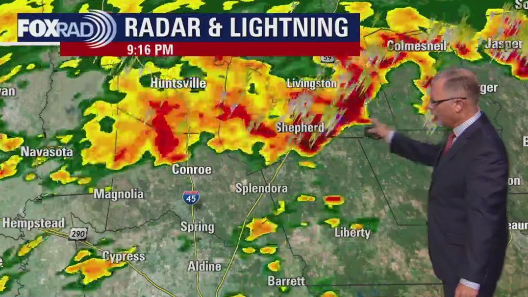
HOUSTON – Another round of storms will move through southeast Texas this evening. Watch live hourly updates in the livestream player above.
Storm alerts
Just east of Texas, the NWS is reporting a Tornado Watch and a Warning in Louisiana.
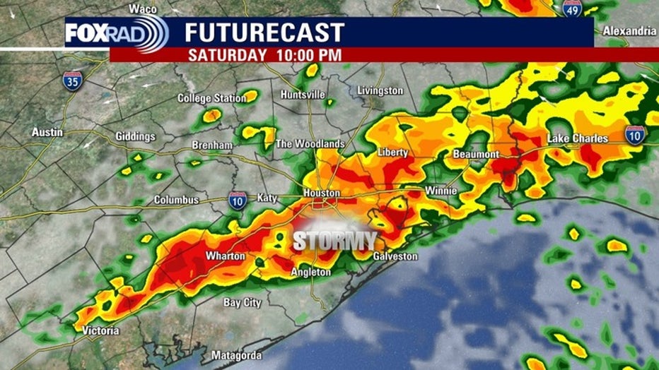
Severe storm, heavy rain threat Saturday night
The expected round of severe storms early this morning brought winds above 50 mph and knocked out power to more than 167,000 Centerpoint customers.
High winds also knocked down trees and there were reports of powerlines down in a few spots. And a confirmed tornado caused damage to homes in Grimes County near Anderson.
Another round of storms will move through southeast Texas this evening.
Look for the worst of the weather to reach Bryan/College Station area around 6-9pm, the downtown Houston area around 10-11pm, and offshore after midnight.
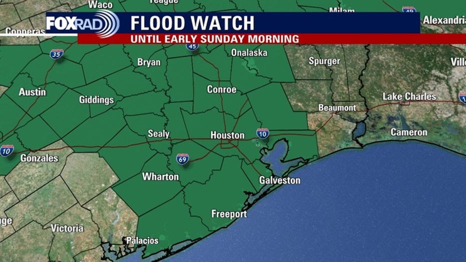
Due to that threat, a flood watch continues until early Sunday.
CLICK HERE to send us your weather photos and videos.
TRACKER: See the latest outage numbers, map
Isolated severe storms are a concern tonight as well, with wind and hail both possible.
Watch live radar in the livestream player below.
Great weather follows
Following the stormy weather, a refreshing cool front is expected to bring pleasant temperatures and calmer conditions by next week.
There is a good chance that we’ll have lows in the 50s and possibly even some 40s by Friday morning.
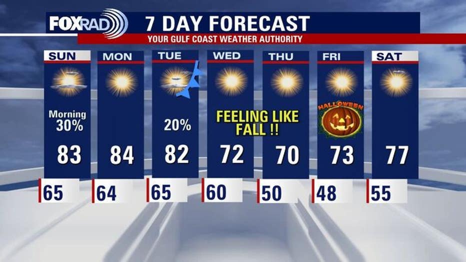
For now, Halloween is shaping up to be cool and dry with some of the coolest low temperatures since early April.
Dangerous hurricane threat to Caribbean
Tropical weather update – October 25, 2025
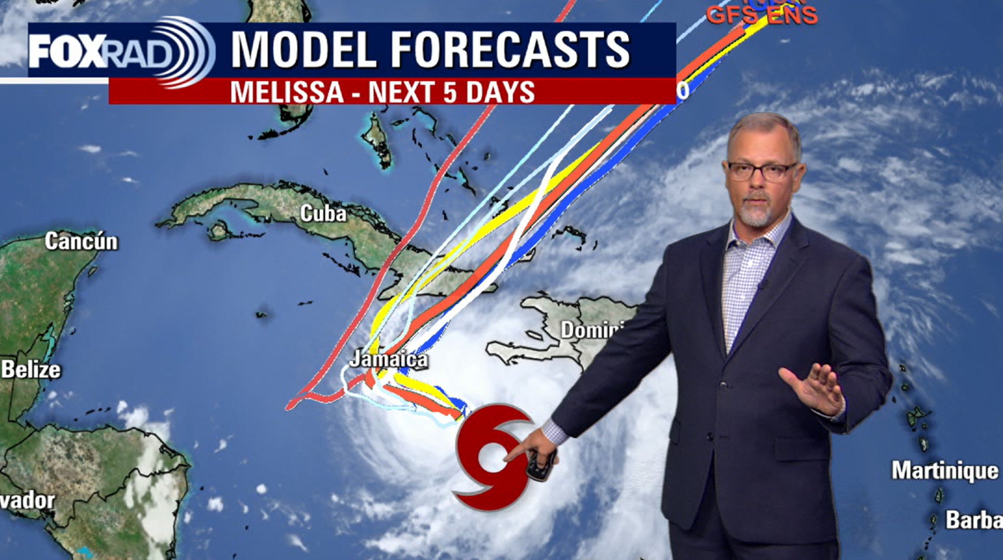
Melissa is now a hurricane and forecast to become a major hurricane in the next 24 hours. The slow movement of this storm will cause flooding to Jamaica before the very highs winds slam the island early this week. Jamaica could be in for 48 hours of hurricane force winds, which is rare. The storm will move quickly into the Atlantic Ocean with no impact on the Gulf Coast.
Melissa is now a hurricane and forecast to become a major hurricane in the next 24 hours.
The slow movement of this storm will cause flooding in Jamaica before the very high winds slam the island early this week. Jamaica could be in for 48 hours of hurricane force winds, which is rare.
The storm will move quickly into the Atlantic Ocean with no impact on the Gulf Coast.
The Source: Your Gulf Coast Weather Authority.