
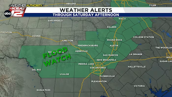
Plan for storms in the area through Saturday morning
WATCH LIVE RADAR IN THE MEDIA PLAYER ABOVE
FORECAST HIGHLIGHTS
-
STORMS TONIGHT: 12AM-9AM Saturday, some could be strong/severe
-
THREATS: Street flooding, gusty winds, isolated hail
-
TORNADO POSSIBLE: Near Canyon Lake
FORECAST
STORMS LIKELY OVERNIGHT
Plan for intermittent heavy rain and frequent lightning/thunder from 12am-9am, then we get a break followed by redevelopment of scattered storms Saturday afternoon.
Strong/severe storms are possible tonight and Saturday afternoon/evening with localized high gusts and localized hail possible. Keep in mind, it’s impossible to know where hail (if any) is going to hit until the hail-making storm develops.
If you have outdoor plans Saturday, don’t cancel them, but pay close attention to the weather.
FRONT NEXT WEEK
Cooler weather is still expected to arrive by midweek with sunrise temperatures in the 50s and afternoon highs in the 70s. Finally Fall will arrive!
QUICK WEATHER LINKS
Copyright 2025 by KSAT – All rights reserved.