
by Raleigh Seamster, Senior Program Manager, Google Earth Outreach
The theory of “natural regulation,” and how wildlife and the surrounding ecosystem should thrive optimally without the presence of humans, is a bit of a misnomer, explains Clifford White, Senior Research Biologist for CW and Associates. As a retired biologist for Canada’s Banff National Park, White monitored the interplay of grasslands, climate change and wildlife — and the park’s reintroduction of bison.
But White has wondered, as have other influential biologists, if natural regulation was ignoring the impact of humans in regions where bison herds were plentiful. Eliminating human impact on wildlife can skew estimates of how many bison can be sustained in a given national park or region without negative effects on other wildlife, water, and plant resources — and on the bison themselves. But how do today’s researchers uncover where, how, and why humans in centuries past intersected with bison?
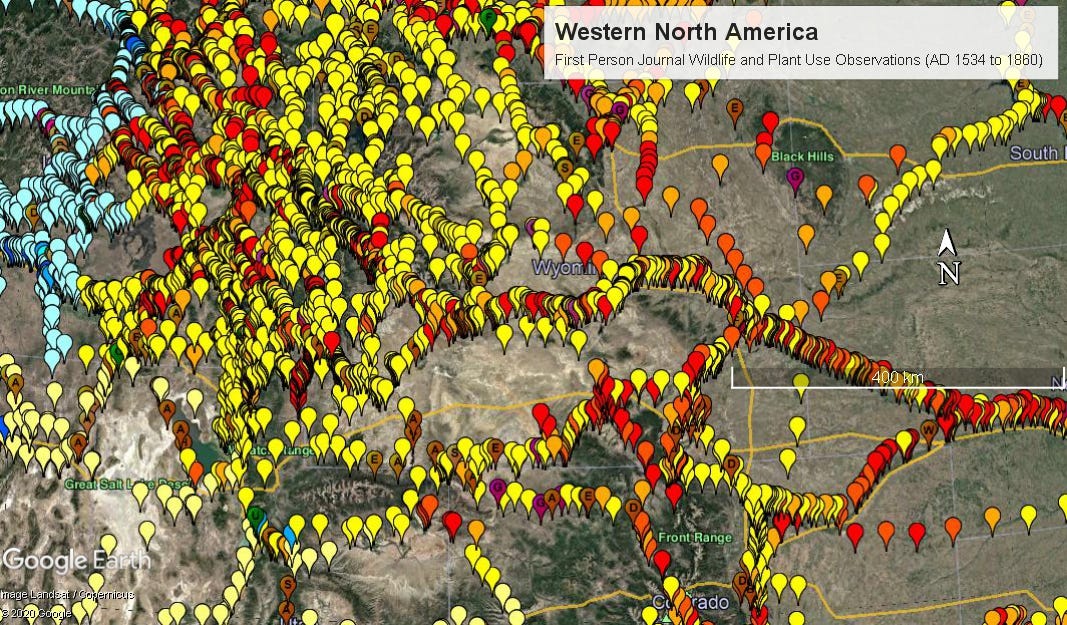
To address this need, White created a Google Earth map linked with thousands of historical wildlife observations of early North American travelers, including Lewis and Clark. The map, part of White’s Lens of Time photo history project, also links to 300 early photographs with recent repeat views across nearly four million square kilometers of North America’s western mountains, adjacent grasslands, and coastlines.
New perspectives on human-wildlife coexistence
As White’s Google Earth map has shown, there were many sightings of hunting activity as well as trading in bison hides, and signs that people were conducting burns of grassland to guide herds’ movements. The research has led to recommendations for maintaining a maximum number of free-roaming bison that can live in Banff National Park in harmony with nature.
When addressing wildlife restoration projects, researchers and scientists must make educated guesses about where wildlife traveled, what they fed on, and how climate, vegetation, and landscape affected their numbers. The leading perspective in North America is natural regulation when it comes to conservation and restoration, White explains — that is, eliminating the human impact. “They like their ecosystems pure,” White says of researchers.
White was skeptical about skipping over human impact when studying wildlife conservation, and thought over-restoring wildlife would have a negative impact on other parts of parks such as Banff.
“As a plant ecologist, the number-one thing you always do is you keep the grass, the aspen, and willows, and you look after the riparian zones along the streams,” White says. “ If you ignore them, you’ll have an ecological train wreck. You’ll be out of the national park business.” Too many animals could mean that ecosystems for food and plants suffer.
To counter the guesswork, White used Google Search to find historical first-person accounts from travelers and explorers. He created the Google Earth map using typical data sets for temporal change and weather, but also added points for locations of historical observations from 1528 to about 1920.
As of 2024, the map includes 20,000 days of historical journal observations plotted and listed by date and location for most of North America, often including information on Indigenous peoples and the presence or abundance of native species. The mapping points are color-coded and shaded for the prevalence of types of wildlife, such as red for bison observed or killed, and dark blue for major fishing areas.
Where available, the map points also link to photos, such as the image below of Henry’s Lake, Idaho. Historical observations record the presence of bison bones from ancient campsites as well as “wallow beds” where bison roll in soft soil.