Happy Saturday, South Florida!
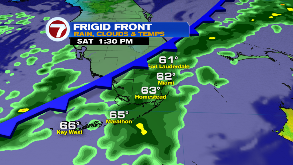
A dramatic drop in temperatures is coming as a powerful arctic cold front sweeps across the area this afternoon.
Ahead of the front, we’ll see widespread showers and perhaps a rumble.
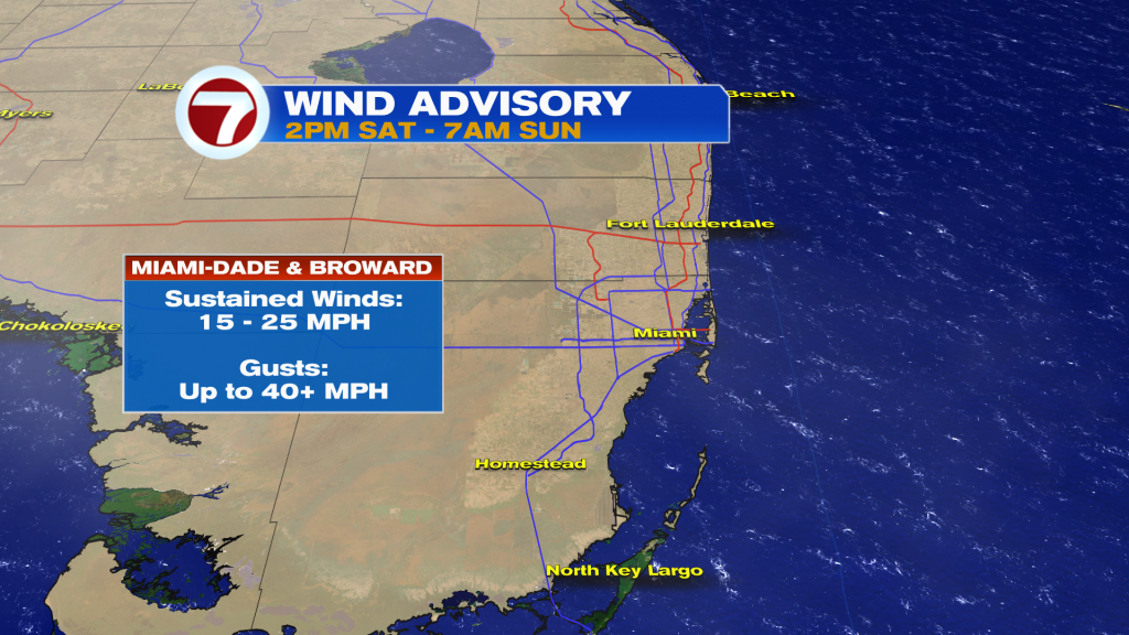
Behind it, we’ll turn very windy and sharply colder. In fact, winds are forecast to gust well over 40 MPH, which has prompted the NWS to issue a wind advisory. This advisory will be in effect from 2PM Saturday through 7AM Sunday.
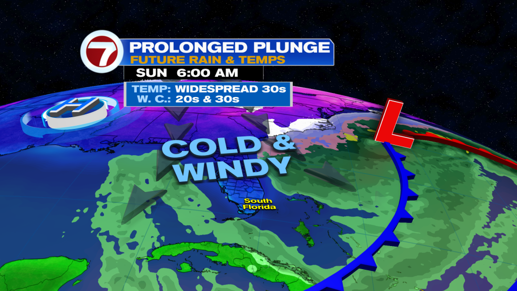
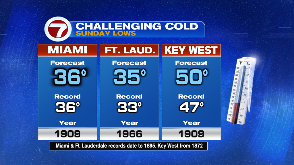
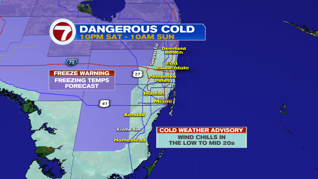
Winds will be the strongest Saturday night and will be out of the northwest, guiding in the Arctic air mass. That will cause temperatures to plummet with widespread lows in the low to mid 30s and wind chills in the low to mid 20s across Miami-Dade and Broward. Miami is even forecast to tie its record low of 36F!
A Cold Weather Advisory is in effect for all of Miami-Dade and Broward due to the dangerous wind chills. A Freeze Warning is also in effect west of Krome Ave, US-27 and the Sawgrass Expressway, which is where freezing temperatures are expected.
Both of these weather alerts will be in effect from 10PM Saturday through 10AM Sunday.
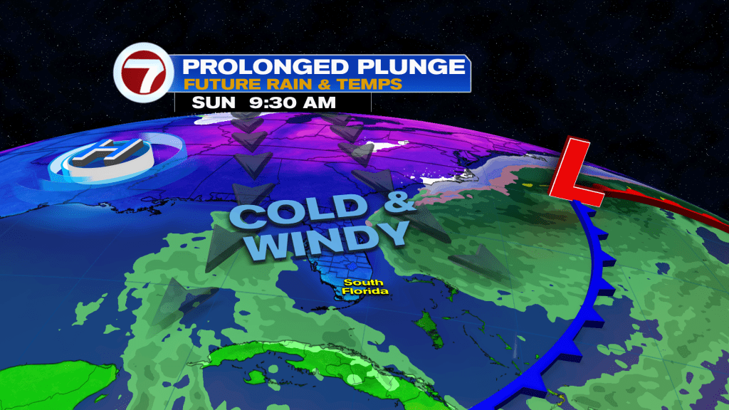
Despite the alerts expiring in the morning, Sunday will be very cold day with temps only “warming” into the low 50s. It will feel like the 40s throughout the day due to the windy conditions. At least it will be sunny!
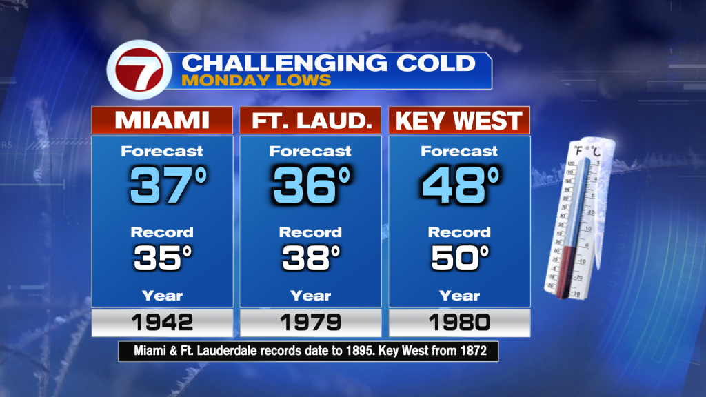
Monday will then be another very cold day with widespread lows very similar as Sunday (just with lighter winds so it won’t feel as bad). Both Fort Lauderdale and Key West could break their record lows for the date.
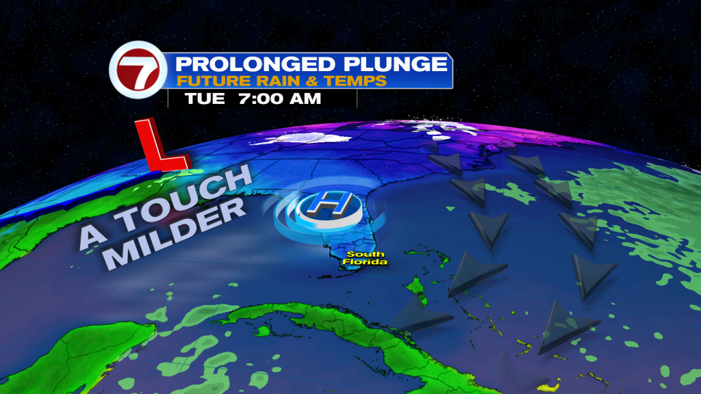
Tuesday remains cold, too, with lows near 40F and highs now rebounding to the 60s.
It’s not until mid next week when we will continue to warmup but the mornings will still be on the cool side. Another front could arrive by next weekend, dropping temperatures back down, however.