Let’s call Saturday the appetizer.
After the city saw roughly an inch of snow to start the weekend, a second event could bring double the amount of snow on Sunday — and the action has already started.
A significant change to Sunday’s storm has now moved its trajectory westward, triggering weather advisories in the event we see truly plowable snow.


Although snow will be the star attraction on Sunday, it gets to take a break midday after the morning flurries are finished with their fun. The snow is expected to be off-and-on through the rest of the morning before a brief pause around lunchtime.
What comes later will surely be heavier and more widespread.
When the action picks back up in the afternoon — likely around 3 p.m. — be ready for more snow. Once it starts again, don’t expect a break until late tonight.
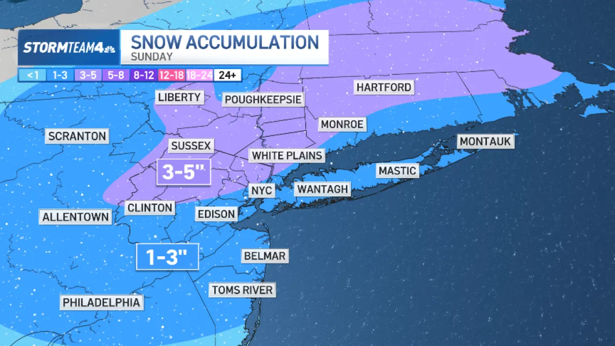
How much snow are we expected to see once things wrap up? Those in the city, out on Long Island and central New Jersey may have anywhere from 1-3 inches to contend with. While areas more north and west could see up to 5 inches, potentially.
Once Sunday’s system clears the region, a rush of cold air will deliver our coldest temperatures of this winter so far.
By Tuesday and Wednesday morning, temperatures in New York City will bottom out in the mid to upper teens. Highs on Tuesday will languish in the 20s! And beyond that, for the balance of the week ahead, we’ll be feeling the chill. Temperatures will be below normal all week long.
The snow picked back up Sunday morning for the second of two weekend snow events for the New York area. NBC New York’s Jessica Cunnington reports.